One and a half years after the tsunami

This is the fourth part (see also parts one, two and three) of an open ended series to document the recovery of the tsunami hit coast of northeastern Japan, where nearly 20,000 people lost their lives, and entire towns were destroyed in the afternoon of March 11, 2011.
One and a half years after the tsunami, we revisited some of the worst hit cities along the Sanriku Coast in Miyagi and Iwate Prefectures on October 12 and 13, 2012. On the first sight, not much drastic change was visible, but on a closer look many steps towards recovery were noticeable.
Clean-up efforts were already far advanced half a year ago, but in some places the demolition of large buildings was still ongoing. Furthermore, work on reinforcing the coastline and preventing districts from flooding have advanced. The mountains of debris have also finally started to shrink in size. Furthermore, shops, restaurants and services for the local population have further increased.
All major roads had been repaired a while ago already, and getting around by car posed no problems, whatsoever. Most coastal railway lines, however, remained disrupted, and reconstruction has not started on most of them. Instead, substitute bus lines were operating.
Another visible change was the increase of tourism to the region, both to the region's traditional sightseeing spots but also to the affected towns and cities for people to see and understand the destruction. Tourism to the region has been actively promoted and is seen as an important tool for revitalizing the region. A new sight were also multiple "recovery markets", collections of shops and restaurants catering both to local residents and visiting tourists.

This time we drove the coast from north to south, starting in Miyako City where several districts were badly hit by the tsunami. Miyako is famous for its spectacular coastline, which is part of the Rikuchu Kaigan National Park. We visited the Jodogahama Beach area which has been prominently promoted in advertising campaigns in the Tokyo area in recent months and where tourist facilities have been repaired and reopened in the meantime.

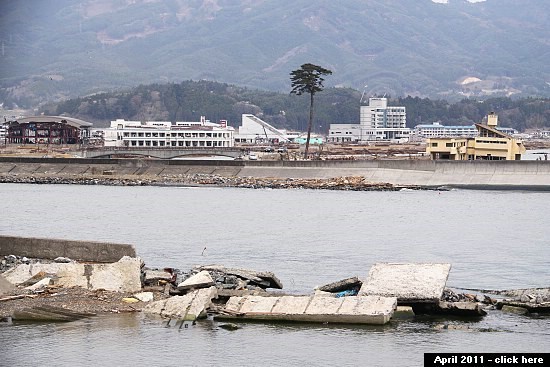
Compare: October 2012 - April 2012 - April 2011


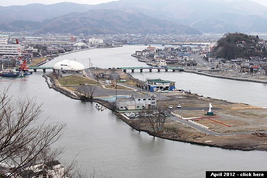
Next we visited Rikuzentakata whose entire city center was destroyed by the tsunami. While the former city center remained largely unchanged from our last visit, the new shopping district just outside the center - mostly built with temporary structures - has further increased in size and now offers an even wider variety of services.
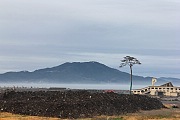
A prominent change in the city's skyline was the disappearance of the "miracle pine", the only tree that survived the force of the tsunami among several thousand coastal pine trees. An instant symbol of recovery, the tree later succumbed to the salt in the soil, however, and was recently cut down in order to be reinforced and reerected as a permanent monument. We should be able to see it again on our next visit planned for April 2013.

Compare: October 2012 - April 2011


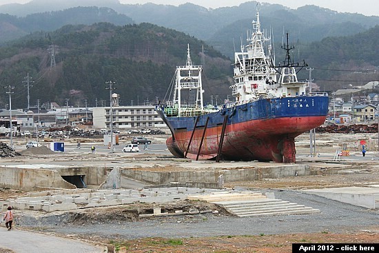
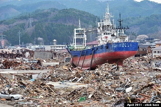
The overall scenery in Kesennuma, where several districts were destroyed by the tsunami, did not drastically change, either. Not far from the stranded large ship in the badly affected Shishiori district, a "Recovery Market" caught our attention. Consisting of about two dozen small shops, cafes and restaurants in 2-storied temporary housing, the market caters to people living in the area or wishing to move back there one day, as well as to volunteers and tourists.

Compare: October 2012 - April 2012 - April 2011


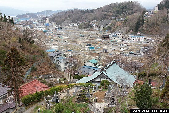
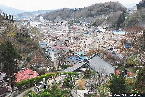
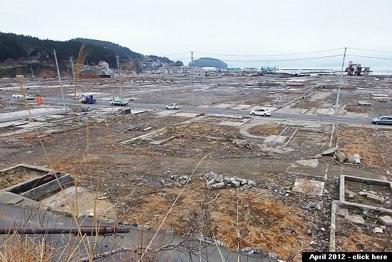
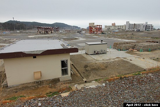
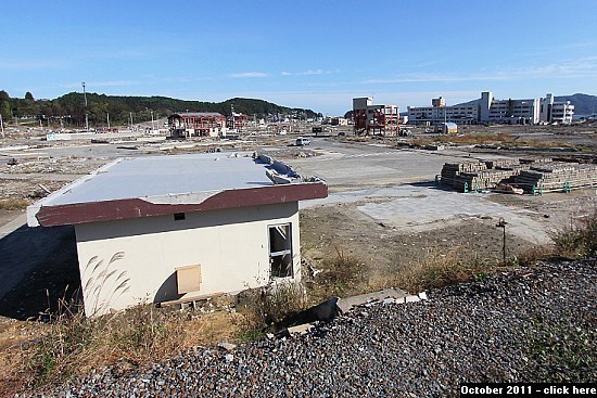
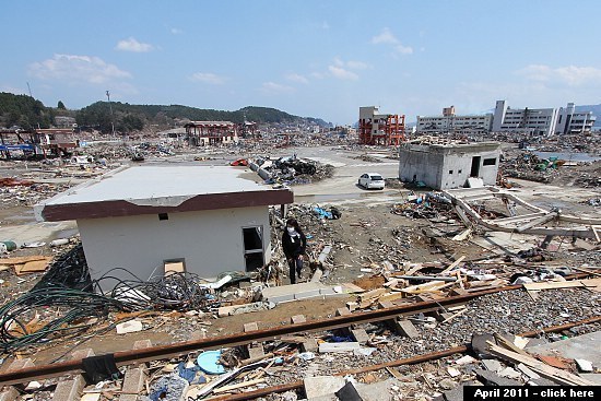
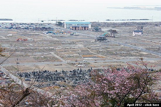
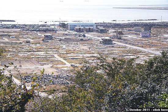
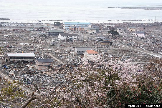
We continued to drive southwards to Minamisanriku whose town center was completely destroyed by the tsunami. Several large buildings in the town center have been torn down since our last visit in spring. A steady stream of tour buses brought visitors to the town's former disaster prevention office building which has become a symbol for the disaster and recovery efforts as well as a site for people to pay their respect to the victims.

Compare: October 2012 - April 2012 - October 2011 - April 2011
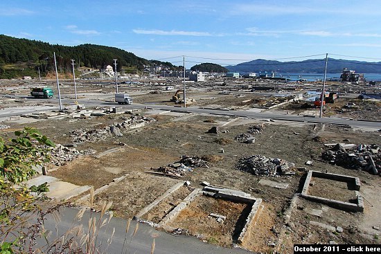
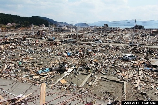

Compare: October 2012 - April 2012 - October 2011 - April 2011


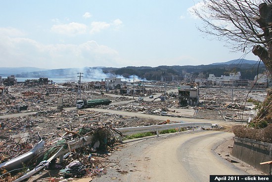

Compare: October 2012 - April 2012 - October 2011 - April 2011


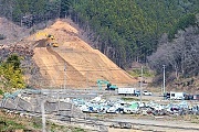
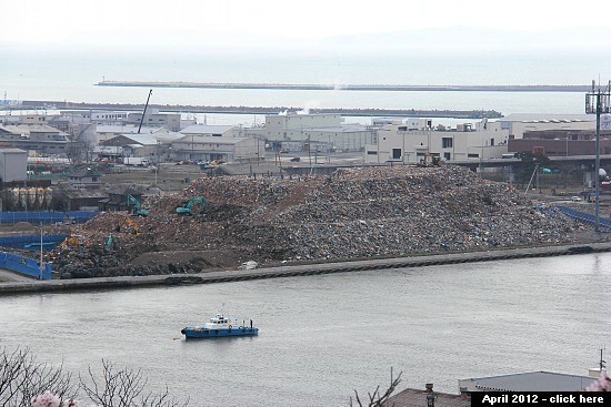
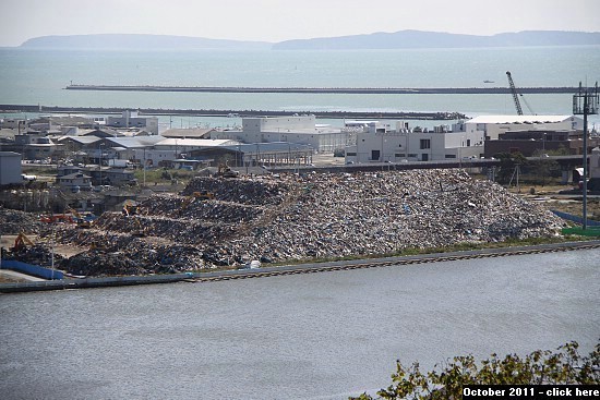
In Ishinomaki, the city which suffered the most casualties of any municipality, the mountains of debris have finally started to decrease in size. On another positive note, the Ishinomori Manga Museum just announced that it will re-open its doors on November 17, 2012, followed by a full re-opening on March 23, 2013. The museum was fully exposed to the tsunami and suffered a lot of damage while structurally remaining intact.

Compare: October 2012 - April 2012 - October 2011 - April 2011

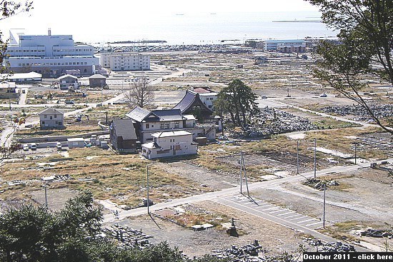
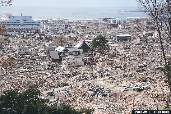

Compare: October 2012 - April 2012 - October 2011 - April 2011

Compare: October 2012 - April 2012 - April 2011
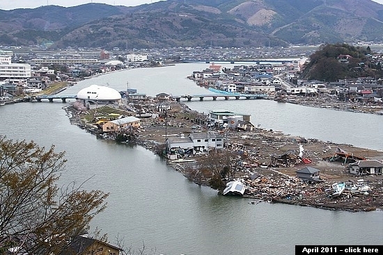

Compare: October 2012 - April 2012 - October 2011

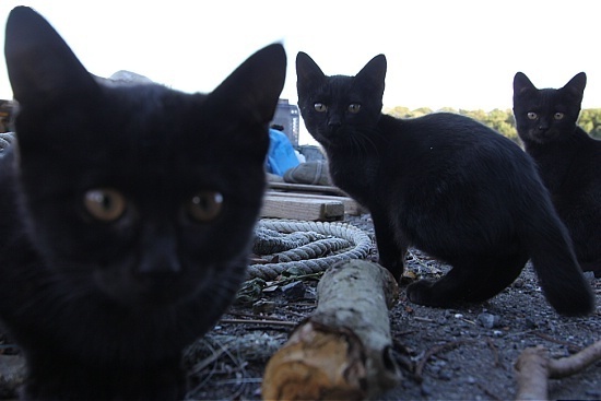
From Ishinomaki we took a one-hour ferry ride to nearby Tashiro Island, also known as "Cat Island" due to its large feline population. The island suffered from both the earthquake and tsunami, but thanks to its somewhat protected location behind a peninsula, the loss was not as devastating as elsewhere.
The island is a popular tourist destination among cat lovers despite the fact that its two small villages offer barely any tourist amenities. Today, too, we were in the company of about a dozen other tourists who must have raised the island's daytime population by over ten percent. The local cats, nevertheless, vastly outnumbered us humans.


In the near future, japan-guide.com will add a section about the Sanriku Coast, including the above mentioned attractions, to our sightseeing guide with practical details for tourists interested to support the region by visiting it.