Autumn Color Report: Urabandai
by Scott, staff writer of japan-guide.com
This journal is a log of my travels within Japan. Here you'll find my personal opinions on the places I've been and the things I've seen. Also expect to see the occasional review and editorial. Thanks for reading.
| previous post |
| next post |
2013/10/28 - Autumn Color Report: Urabandai

Today I headed out to Fukushima Prefecture to check out the autumn colors (koyo) in Urabandai, the highland slopes to the north of Mount Bandai. Due to the large changes in elevation around the mountain, the colors around Urabandai tend to be good for the entire month of October as they slowly make their way down the slopes. Indeed, today you could easily see the affect that elevation has on the koyo, as the best fall colors were found about 2/3rds of the way up the mountain slopes, with duller foliage higher up and greener foliage below.
My first stop today was to Goshikinuma (5 color ponds), a popular hiking trail that leads around some of the small lakes and ponds that dot the Urabandai area. The koyo around each of the various colored ponds was at a slightly different state depending on the types of trees that were most numerous, but generally it looked as if the colors were at or still approaching the peak around most of the area. The maples and Japanese Rowan (nanakamado) especially were beautiful shades of red and orange this morning, while later season varieties, such as the larch trees, were only just beginning to color.


After finishing the hike, I drove over to the Bandai Azuma Lake Line toll road that connects Urabandai with Mount Azuma. Toll collection along the Bandai Azuma Lake Line has been suspended indefinitely to promote tourism to the area.
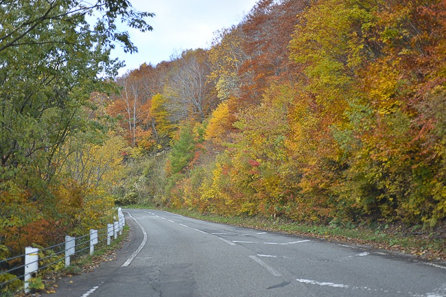
Just like last year, the trees along the lake line were some of the most advanced of the day. They seemed just a bit before the peak compared to last year (which is understandable since it was two days later by comparison), but the views were just as spectacular from the different turnouts and viewpoints along the route.


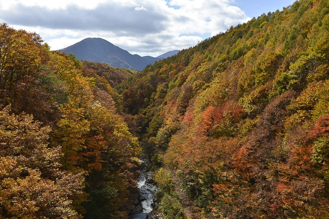
One of the highlights along the Bandai Azuma Lake Line is Nakatsugawa Bridge, which spans a deep gorge and gives visitors some really beautiful views out over the mountain slopes. The trees around the bridge were simply amazing today, with bright reds and oranges all over the surrounding slopes.
There is a parking area and rest stop just past (and slightly above) the bridge, from where you can hike down to the bridge level as well as further down into the gorge below. Since the weather was good today, I (together with scores of other koyo hunters) headed down the trail to check out the nice colors below. It is only a ten minute walk, and definitely worth the time.


Unlike last year when it had just rained, the rocks along the river were only moderately slippery/dangerous today, so I decided to explore the area and figure out how to reach the trail that is nestled up along the cliffside on the far bank. Actually it wasn't as difficult as I had though, but you do have to scramble about a hundred meters upstream on the slippery rocks until you come to an old, decrepit bridge that crosses the river.
That trail ended up being better than I had expected and there were beautiful colors and scenery around every bend. I hope to explore this area more in the future as it seems like this old trail might lead quite a ways along the river. I'd just be sure to bring a good pair of waterproof boots as the track was a marshy, muddy mess from the streams of water that wept from the face of the cliff.


I departed Urabandai via the Nishi Azuma Sky Valley along prefectural route 2 to Yonezawa. This wasn't intended to be part of the reporting, but the views were just too good not to share.


| previous post |
| next post |


