Walking the Shin-etsu Trail: Part 2

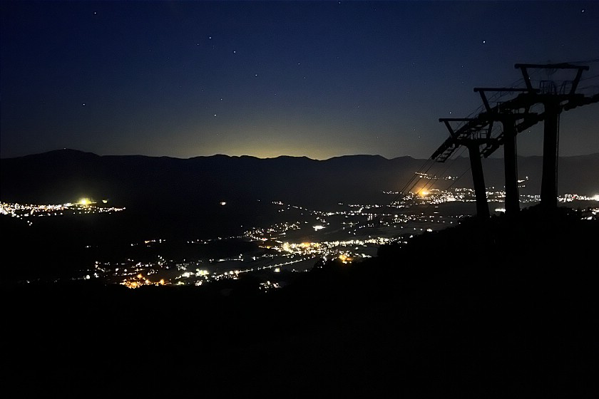
After a promising start to this series in June of last year when I walked the first two sections of the Shin-etsu Trail, I couldnüft wait to return. Fate however, had other ideas - and with my desk piling up with other exciting projects and the months ticking by, it seemed like I might never get to finish it. What a delight then, to find myself once again speeding through beautiful countryside on a shinkansen bound for Iiyama Station and the next two parts of this epic hiking route.
While only the most committed long-distance hikers would want to take on the entirety of the 110 kilometer trail in one go, its remoteness can also present a few challenges to those - like me - planning to pick it up one section at a time. To reach my previous end point at the small hamlet of Wakui , I would need to take a taxi from the station.
Day 3 (12.7 kilometers, 6 hours)
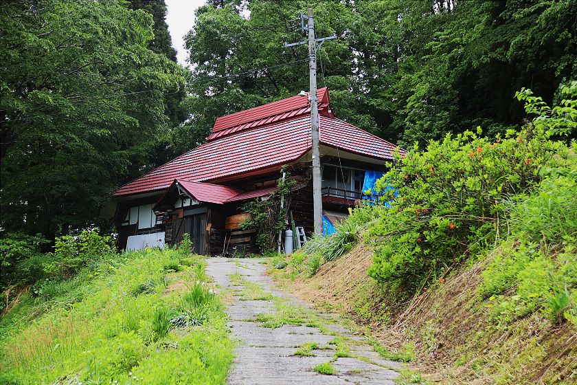
After winding my way for around 20 minutes along quiet country roads, I instantly recognized the scattering of rustic-looking houses and their distinctive steeply slanting roofs - a reminder of the heavy snows this region experiences every winter.
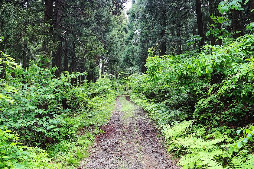
Once out of the taxi, I soon found a trail marker and was once again pushing my way up a sloping path with thick undergrowth pressing in from both sides, still beaded with moisture from the previous day's heavy rain. Despite my worries, the ground was reasonably solid underfoot and the air was pleasantly cool.
A few winds in the trail brought me to my first point of interest - the Tomikura Toge (elevation 679 meters). Despite its exact route changing several times due to avalanches, this low mountain pass between Niigata and Iiyama has been well-trodden since the era of warring states. According to local lore, the famous warlord Uesugi Kenshin brought his army this way to fight his arch-rival Takeda Shingen at the Battle of Kawanakajima (1561).
Casting about for something appropriate to offer their visiting feudal overlord, inhabitants of Tomikura - a hamlet that still exists at the foot of the pass - are said to have brought him a kind of sushi made from mountain vegetables and wrapped with a sasa leaf. Fortunately, Kenshin was reputedly much satisfied and it remains a popular local dish in Iiyama today.
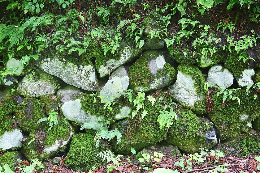
For much of the Edo Period (1603-1868), four kilometers of the pass were paved with stone and a number of small teahouses catered to passing travelers, but all this vanished almost overnight with the construction of the Wakui Tunnel. All that remains are a few sections of rock wall lining the path, some dating to 1891.
30 minutes and about 30 meters of elevation later, I arrived at the Sobu no Ike, a large, comma-shaped pond surrounded by tall evergreens. Until now the trail had been peaceful - the quiet broken only by the murmur of traffic rising up from the valley - but here it was almost eerily silent.
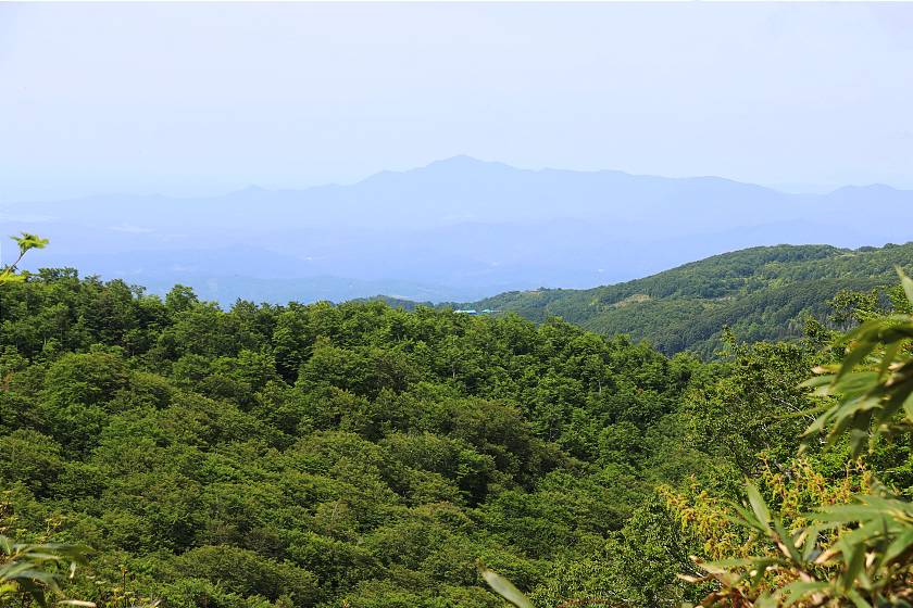
Turning away from the pond to the north, I continued for around 3.5 kilometers along a dense, undulating forest trail towards the summit of Mount Kuroiwa (elevation 911 meters), occasionally catching glimpses of the valley below through gaps in the canopy. After winding this way and that for the first half of this stretch, the path straightened suddenly as I reached the ridgeline, the thick undergrowth forming a green tunnel.
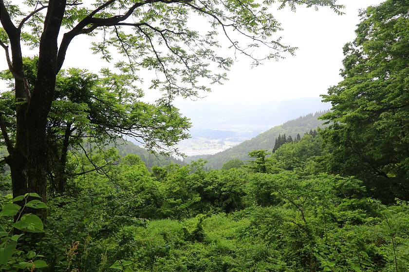
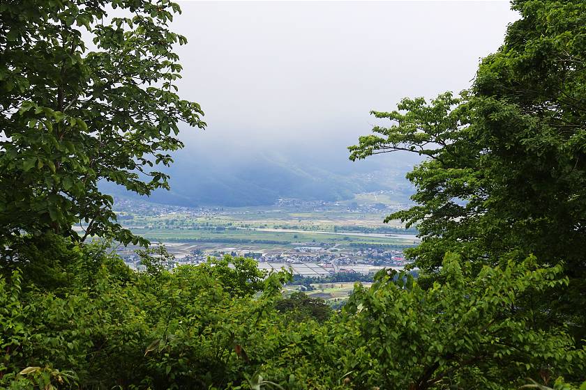
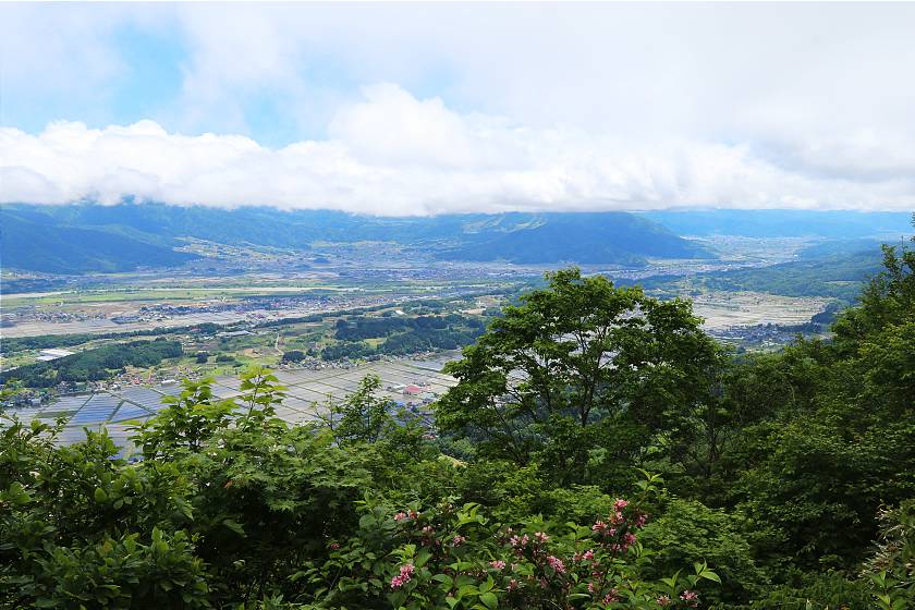
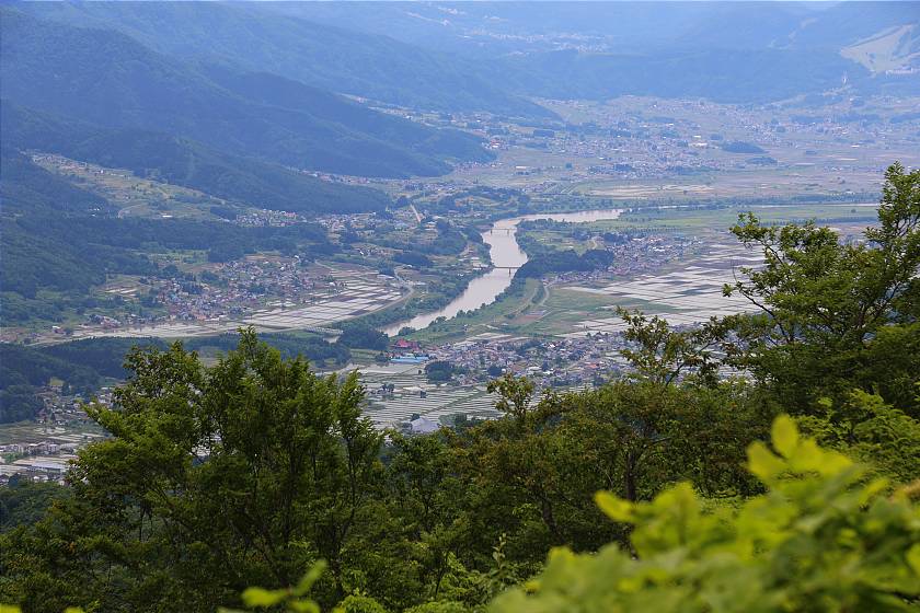
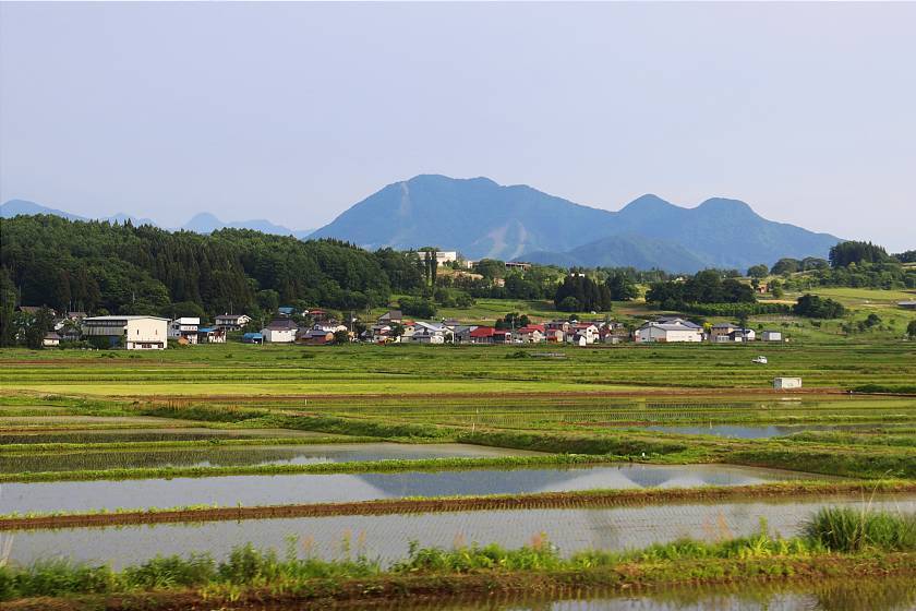
Close to the summit, I paused for a bite to eat under a wooden pavilion with the first spectacular view of the day. By now, the clouds were beginning to clear, and sunlight sparkled on the surface of hundreds of little rice fields on the near side of the valley, turning them into mirrors.
After the summit, the path turned quite steeply downhill, requiring careful footwork to avoid getting snarled by roots or slipping on patches of soft mud concealed under leaves. After a little under two kilometers, I suddenly emerged onto a paved road at the Hiramaru Pass - once a popular thoroughfare connecting what is today Joetsu City with Nozawa Onsen.
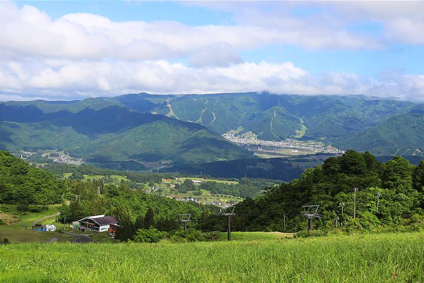
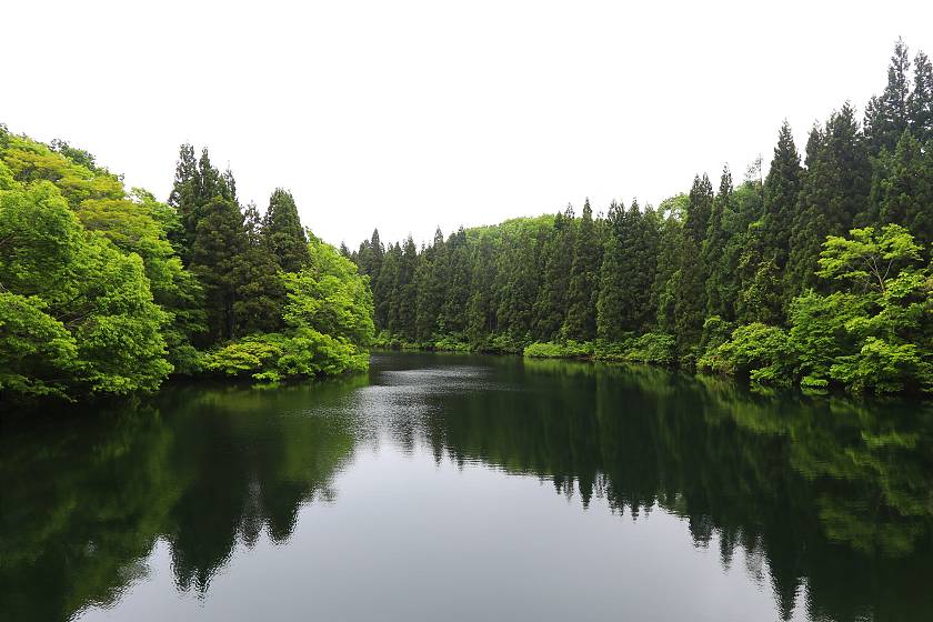
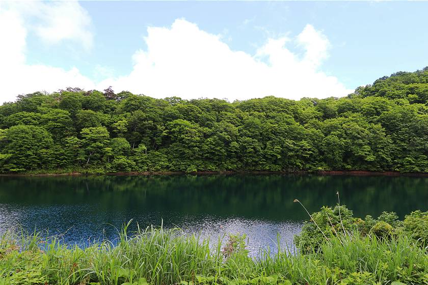
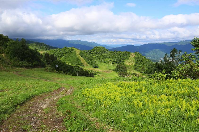
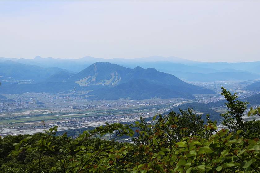
Pausing for a quick rest at the very scenic Katsura Ike Pond, I made a final three kilometer push through cedar forest and clearings crowded with bracken. Just as I was beginning to wonder if I might have made a wrong turn, I stumbled out from the treeline and onto the upper part of the Tondaira Snow Resort, with some spectacular views down the slopes and into the valley beyond.
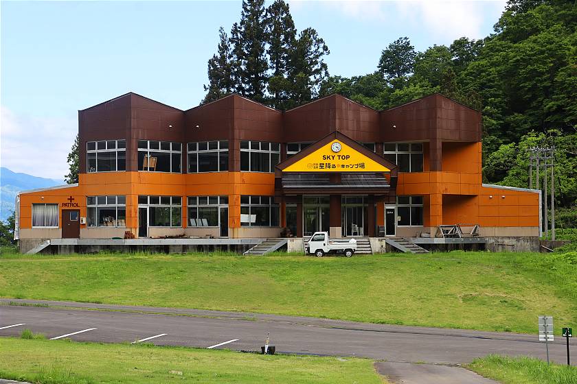
With the day's efforts beginning to catch up on me, I made my way lazily downhill and across the slopes to the Togari Onsen Hoshifuru Campground, a portion of which is rented by the Shin-etsu Trail Club for hikers to make use of. Tomorrow would be another challenging day of hiking, but for now all that remained was to put up my tent, get myself something to eat and enjoy the view while the sun lasted.
Day 4 (8.5 kilometers, 5-6 hours)
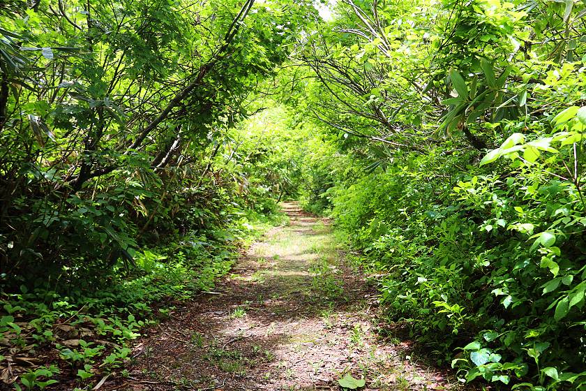
Making an early start the next morning, I packed my camping gear away and retraced my steps back up the slopes to the Hotokegamine trailhead - an unmarked path leading up into the forest, directly across from the opening I had emerged from the previous afternoon. From here, the trail led up a steep slope with multiple switchbacks, the dazzling view across the slopes quickly receding as undergrowth closed in once again from both sides.
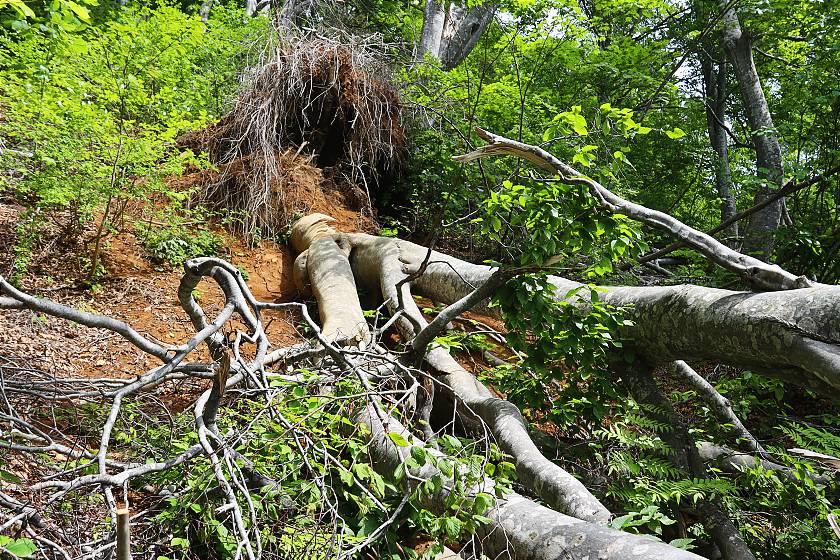
Walkers on the Shin-etsu Trail quickly get used to overcoming the occasional challenge as part and parcel of hiking in such a remote location, but in this section I found something entirely new to contend with - a series of newly toppled beech trees blocking the path in a tangle of roots and broken limbs. Fortunately, with some effort and a few scratches I was able to make it through, but these could easily have ended today's walk almost before it had begun.
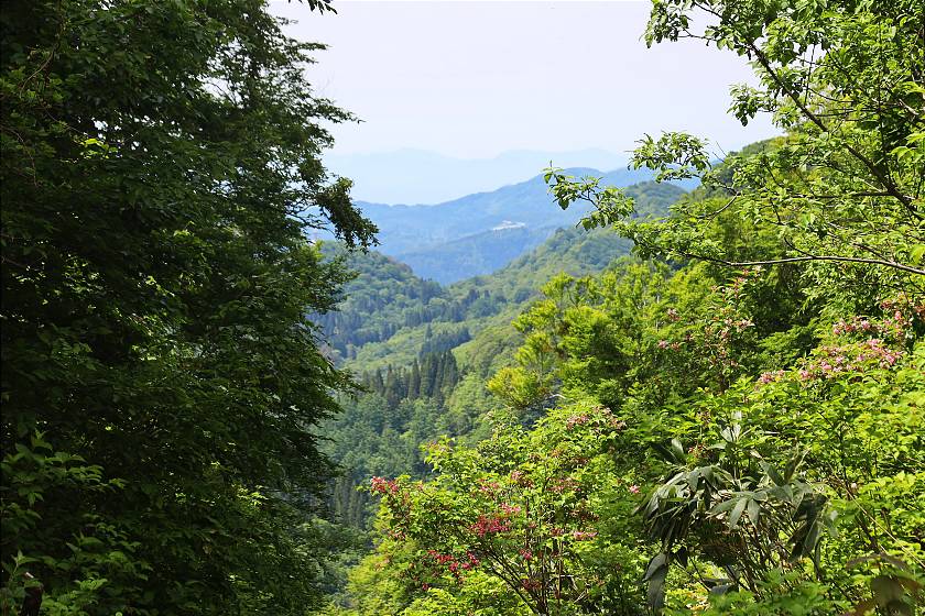
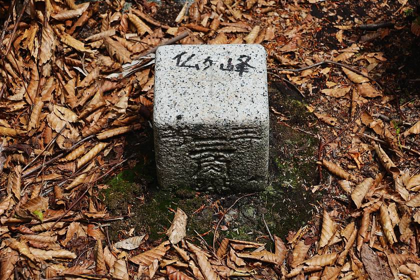
Having traversed over the ridge and into a dip on the opposite side, I found myself on a straight path up the ridge towards the summit of Hotokegamine (elevation 1146 meters). While the summit itself was completely overtaken by foliage, occasional gaps in the trees created unexpected glimpses down into the valley below.
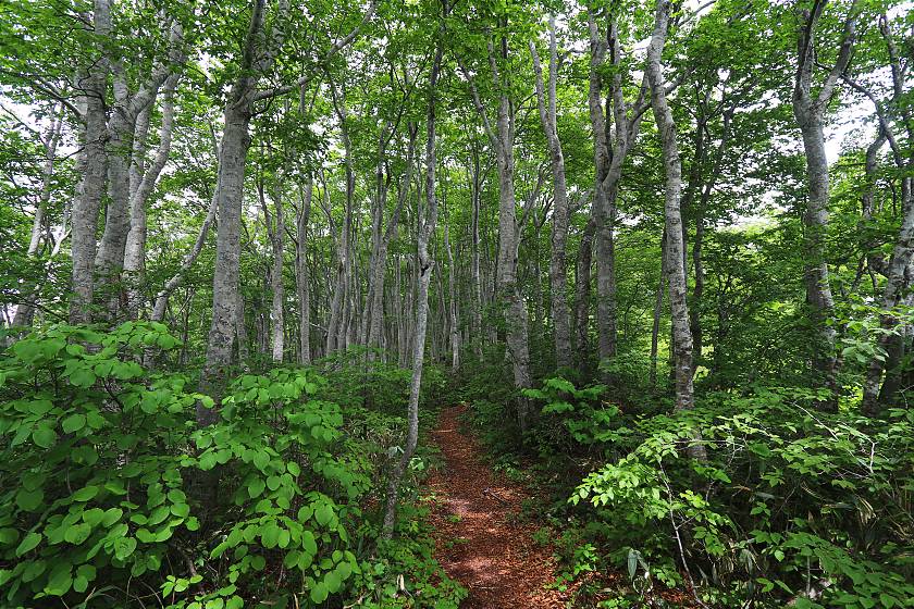
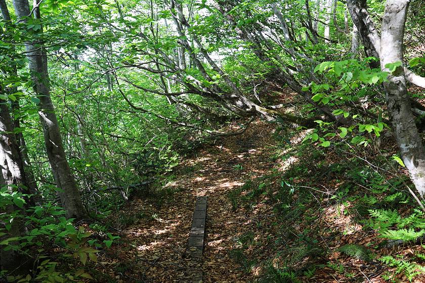
From Hotokegamine, the trail continued along a fairly straight path with a lot of up and down for about 3.5 kilometers, with the surroundings gradually phasing from leafy brush into beautiful beech forest.
Among the highest mountains in the Sekida range, Mount Nabekura (elevation 1288 meters) has long carried the unfortunate nickname of ügBastard Mountainüh as other than enormous volumes of snow in winter, it seemed to contribute nothing to life in nearby villages. In fact, nothing could be further from the truth, as its extensive beech forests are an essential part of the local ecosystem - slowing the snow melts that are the forest's main source of water and diffusing moisture safely down the mountainside.
The beech-heavy parts of the forest are often among its most beautiful - unlike cypress trees, their branches fan out allowing sunlight to filter in through their leaves, while the pale gray bark of their treetrunks contrasts attractively with the surrounding green canopy. Even the curious patterning on their skin is interesting, the product of sea-dwelling lichen carried
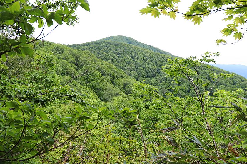
After a while, the forest gave way to a jungly ridgeline with Mount Nabekura's bell shaped peak rising into view. From here, a moderately challenging 200-300 meter push brought me to the summit, and the high point of the second day's walk. Disappointingly, the summit itself was choked by brush but I soon came to a more open spot, and a final view to the Nagano side before descending once again into more beech.
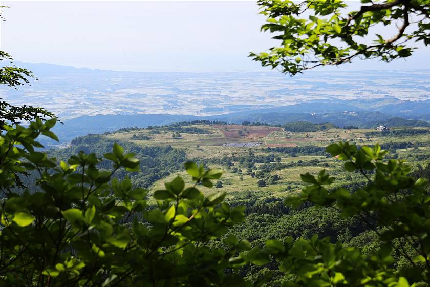
About halfway down the mountain on the opposite side is the Kuguno Toge, known locally as the Pass of Giant Trees. Here, an enormous beech known as Moritaro stood for around 400 years until heavy snow caused it to collapse in 2022. Another called Morihime was believed to have lived for at least 300 years until an investigation back in 2011 confirmed that it had died, possibly due to hikers treading on its roots. Even without the giant trees, the pass stood out as one of the day's most pleasant stretches of woodland, with a few glimpses down onto the Niigata side of the mountain as far as the Sea of Japan.
From here, there remained only a short but steep ascent up to the secondary peak of Mount Kurokura (elevation 1,242 meters) which again came without the reward of a view due to tall undergrowth. For the final half kilometer or so, I wound my way back down to ground level through a final stretch of beech forest. The end was almost in sight, but still I had to dig deep as a series of branches blocked the way - each needing to be climbed over, ducked under or carefully worked around.
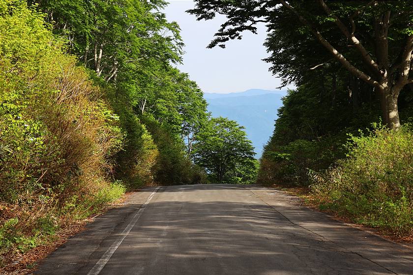
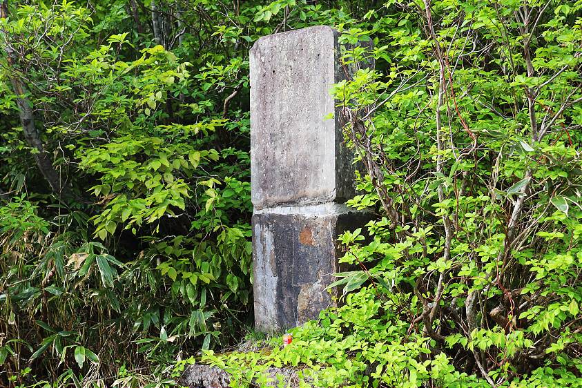
At last, I burst through the treeline one last time onto a paved road with my end point - a stone monument marking the Sekida Toge - directly in front of me. While there is today little to see besides, this mountain pass was once an important point on the old salt road, by which fine white salt from Hiroshima and coarse dark salt from the Noto Peninsula in Ishikawa was carried inland from Joetsu Port.
Duties on the salt were to be paid at a government checkpoint close to the spot where I now stood, but a good deal of the product is said to have slipped quietly over the mountain via the Kuguno Toge - a smuggler's route that would later be revived to feed the black market during the hardship and shortages of World War II.
After a few minutes of blissfully doing nothing at all, my taxi pulled up and I was soon speeding back towards Iiyama Station, passing quaint country houses and the same mirror lens rice fields I had so enjoyed seeing from the mountain.
Links and Resources